
 GPS-coordinates: -34.040978, 20.472165
Driving directions:
Follow the N2 to Swellendam.
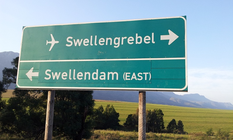
On the N2, directly across the Eastern entrance to Swellendam, turn off onto the gravel road at the road sign that says "Swellengrebel" with an airfield sign.
Follow the gravel road for +-2.3 km until the road ends at two entrance gates, directly after the railway crossing. The entrance to the Bontebok National Park is on the left and the entrance to the airfield is on the right.
The gate to the airfield is usually closed. Please arrange with a member or a committee member to gain access. Alternatively, phone the number that is shown on the gate upon arrival. The gate can be opened remotely and should be open for arranged events at the club.
View larger map